Route: McKinney Falls State Park Hike
Austin is the gateway to the Texas Hill Country. Only ten miles southeast of downtown lies McKinney Falls State Park, the perfect Hill Country escape. Follow the lead of local MapMyFitness ambassador Mason Wheeless, who’s plotted a hiking route suitable for the whole family through these classic Hill Country vistas.
Onion Creek Trailhead: Once on the main road, take your second right and park at the Onion Creek Hike and Bike trailhead near the Upper Falls. The footing is solid, so running shoes will do just fine. Follow the Homestead Trail across the creek and to the right.
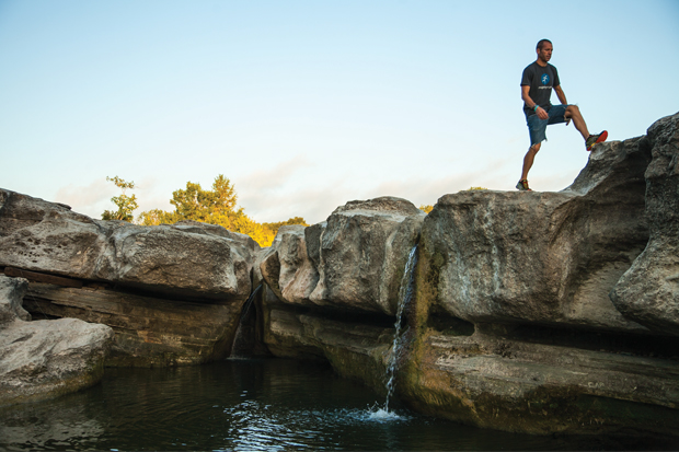
Lower Falls Swimming Hole: Practically all year ‘round—and even in drought conditions—you can find water at the base of Lower Falls. Go ahead and jump on in! Swimming is allowed; you can call the park at 512-243-1643 for current creek conditions.
McKinney Homestead Ruins: Built in 1850 by Thomas McKinney, one of Stephen F. Austin’s first 300 colonists in the early 1820s, the McKinney ruins still watch over the Lower Falls.
Old Baldy: The park is also home to “Old Baldy,” one of the oldest bald cypress trees on public land in Texas. The 103-foot tall cypress tree is estimated to be over 500 years old.
Mileage 4.07 miles
START ELEVATION: 518 FT • MAX ELEVATION: 604 FT
www.mapmyhike.com/us/onion-creek-tx/mckinney-fall-hike-route-54254834
Give us a shout at @AustinFit and @MapMyFitness. We’d love to hear about your route experience!